 -70%
-70%
Sale!
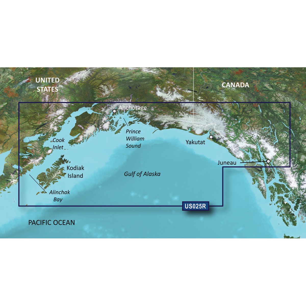
Garmin BlueChart g3 Vision HD - VUS025R - Anchorage - Juneau - microSD/SD
Price
Original price was: $328.99.$149.00Current price is: $149.00.
Free shipping over $40
Calculated automatically
Reliable delivery
Tracking provided when shipped
Easy returns
View return policy
Secure payment
Your payment details are protected
BlueChart g3 Vision HD – VUS025R – Anchorage – Juneau – microSD/SDCoverage:Detailed coverage from Juneau to Alinchak Bay includes Kodiak Island, Cook Inlet, Prince William Sound, Yakutat, Glacier Bay and Icy Strait.Premier Coastal ChartsProvides industry-leading coverage, clarity and detail with updated coastal charts that feature integrated Garmin and Navionics dataAuto Guidance technology uses your desired depth and overhead clearance to calculate routes and show a suggested path to followHigh-resolution relief shading combines color and shadow to give you an easy-to-interpret, clearer view of bottom structure than contour lines aloneDepth Range Shading provides up to 10 depth ranges, enabling you to view your target depth at a glanceUp to 1 contours provide a more accurate depiction of the bottom structure for improved fishing charts and navigation in swamps, canals and marinasExperience unparalleled coverage and brilliant detail on the water. BlueChart g3 Vision coastal charts provide industry-leading coverage, clarity and detail with integrated Garmin and Navionics data, Auto Guidance technology and high-resolution relief shading..Auto Guidance TechnologyThe Auto Guidance feature uses your desired depth and overhead clearance to calculate a route and a suggested path to follow.High-resolution Relief Shading FeatureHigh-resolution relief shading combines color and shadow to give you an easy-to-interpret, clearer view of bottom structure than contour lines alone.Up to 1 ContoursThe closer the contour lines, the more accurate the depiction of the bottom structure for improved fishing charts and navigation in swamps, canals and marinas.NOAA Raster CartographyIf you prefer your display to have the look of paper charts, NOAA raster cartography2 is available as a free downloadable feature via the ActiveCaptain app.Depth Range ShadingThis feature provides up to 10 depth ranges, enabling you to view your target depth at a glance.Shallow Water ShadingThis feature allows you to use shading to designate the shallow water depths you need to avoid.High-resolution Satellite ImageryThese detailed images of ports, marinas, bridges and navigational landmarks help provide you with superior situational awareness.Unique 3-D ViewsMarinerEye and FishEye views provide additional perspective both above and below the water line.Auto Guidance is for planning purposes only and does not replace safe navigation operationsRaster cartography cannot be viewed on echoMAP CHIRP and ECHOMAP Plus combos but can be viewed on mobile devices via the ActiveCaptain mobile appWARNING: This product can expose you to chemicals which are known to the State of California to cause cancer, birth defects or other reproductive harm. For more information go to P65Warnings.ca.gov.This product may not be returned to the original point of purchase. Please contact the manufacturer directly with any issues or concerns. Owner’s Manual (pdf)
Only logged in customers who have purchased this product may leave a review.